


Phase 1 Habitat Surveys
A habitat survey is the basic level of survey required for the majority of sites and projects, 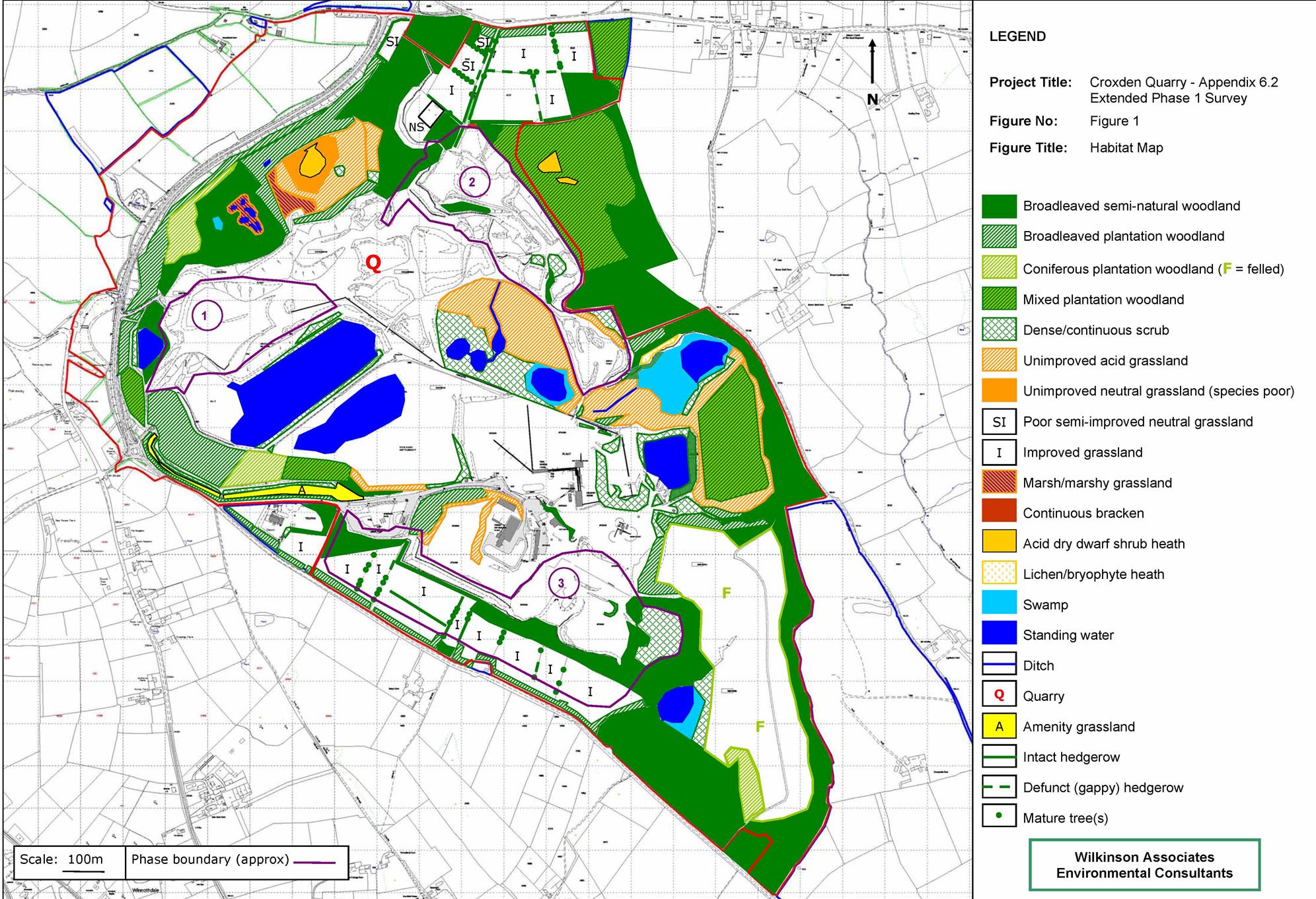 and the standard method used in most instances is a Phase 1 Habitat Survey or Extended Phase 1 Habitat Survey. This involves mapping the type and extent of each habitat type present using a standard set of colour codes, and preparing target notes describing features of ecological interest. An Extended survey also includes noting any evidence of protected or biodiversity priority species and preparing a list of plant species present on the site.
Phase 1 Surveys are often carried out as part of wider assessments, such as a Preliminary Ecological Appraisal (PEA) or an Ecological Impact Assessment (EcIA), but they can also be produced as a stand-alone report if required.
Jan Wilkinson has extensive experience of Phase 1 habitat surveys, having carried out hundreds of surveys in a very wide range of habitats throughout the UK, from farmland and brownfield sites to upland peat bog and coastal saltmarsh.
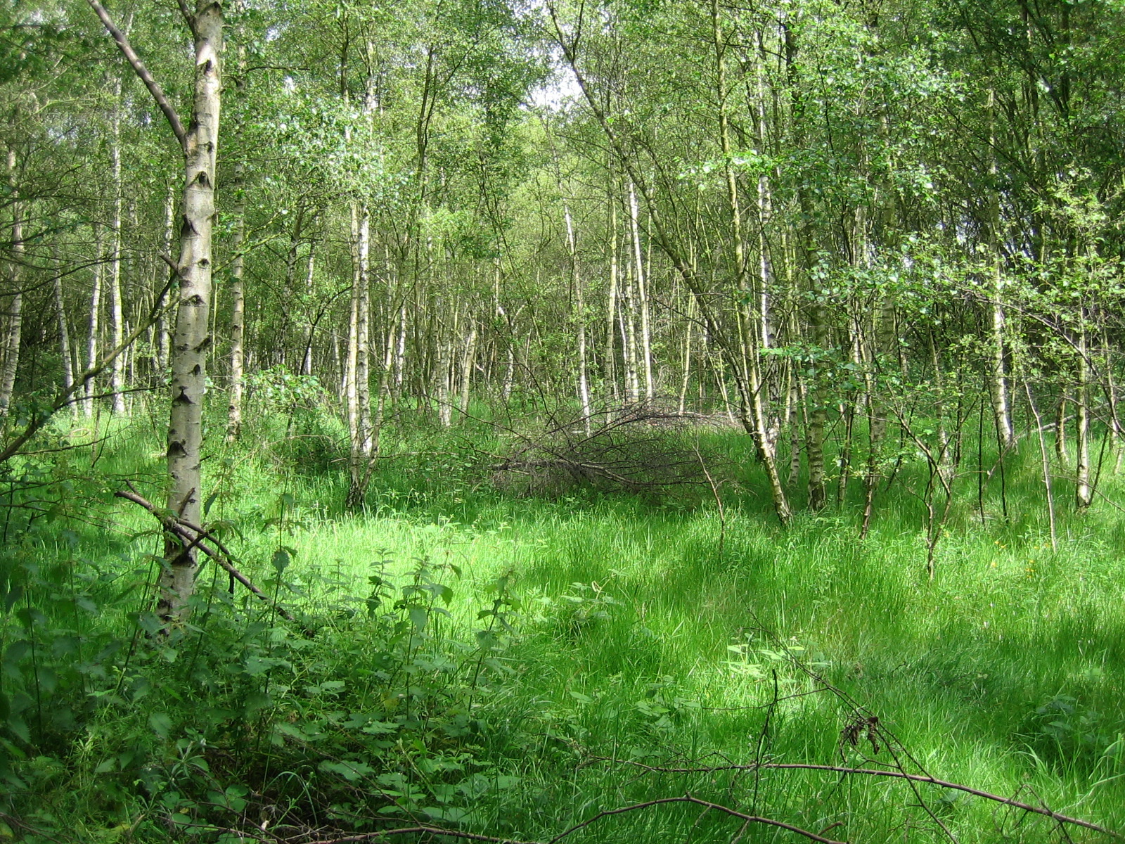
Phase 2 and National Vegetation Classification (NVC) Surveys
 For some sites, a more detailed level of botanical or habitat survey is required; this may be referred to as Phase 2 or National Vegetation Classification (NVC). Examples of sites where detailed vegetation surveys are needed include designated sites (e.g. Wildlife Sites) and those with species-rich or biodiversity priority habitats such as unimproved grassland or mature woodland.
NVC surveys involve detailed analysis of the plant communities present using quadrat sampling and/or published keys. Detailed maps showing the boundaries of different vegetation types may be prepared and the report is likely to include an assessment of the ecological value of the plant communities. This method is more time consuming than a Phase 1 survey and may need to be carried out at a particular time of year, for example in spring for woodland ground flora or summer for wildflower meadows.
 NVC survey tends to be required on larger or more complex sites, often as part of a full Ecological Impact Assessment (EcIA), but it can also be used to inform management plans or as part of a monitoring programme for sites of nature conservation importance. It can also be helpful for monitoring newly created, restored or enhanced habitats.
Other methods can be used for more detailed habitat surveys in some instances, for example River Corridor or River Habitat Surveys.
Jan Wilkinson is a competent botanist and is experienced in carrying out NVC surveys of a wide range of terrestrial, wetland and coastal habitats. She is also trained in river survey methods and aquatic plant identification.
Return to Services